
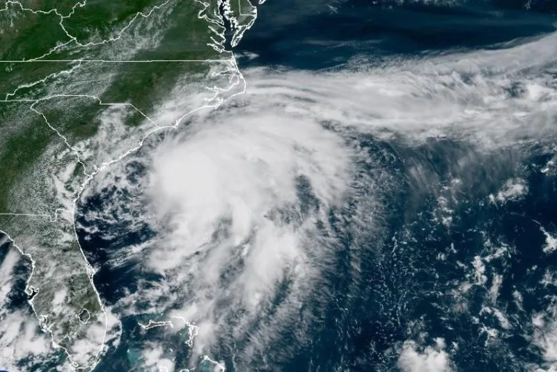
The National Hurricane Center extended tropical storm warnings up to Surf City, North Carolina, as Tropical Storm Chantal moved along the southeastern U.S. coast on Saturday.
Storm Warnings Extended as Chantal Approaches Southeastern U.S.
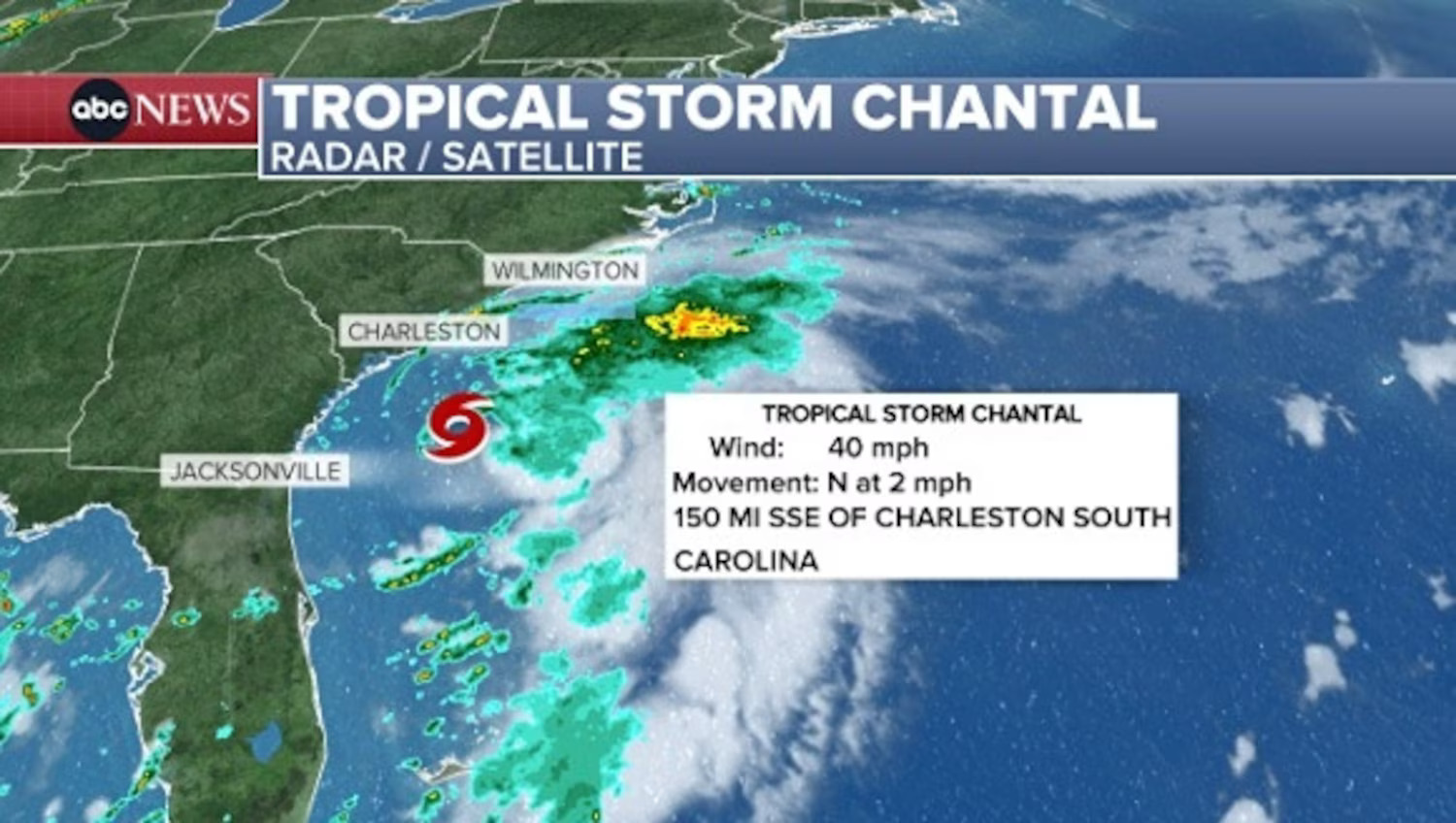
By 2 a.m. Sunday, the storm had gained strength from earlier hours, with maximum sustained winds reaching 60 mph while traveling north at approximately 8 mph.
The National Hurricane Center reported that Chantal’s center was positioned about 75 miles east-northeast of Charleston, South Carolina, at that time.
Chantal’s outer bands brought scattered showers and thunderstorms to parts of the South and North Carolina coastlines Saturday evening, while rough surf and dangerous rip currents increased along the shore.
The storm’s approach toward the coast will cause conditions to worsen in the coming hours. Forecasters expect little change in the storm’s strength before it makes landfall, which will likely happen before sunrise.
Portions of the Carolina coastline from South Santee River to Surf City, where the Tropical Storm Warning remains in effect, were expected to experience tropical storm conditions beginning Saturday evening.
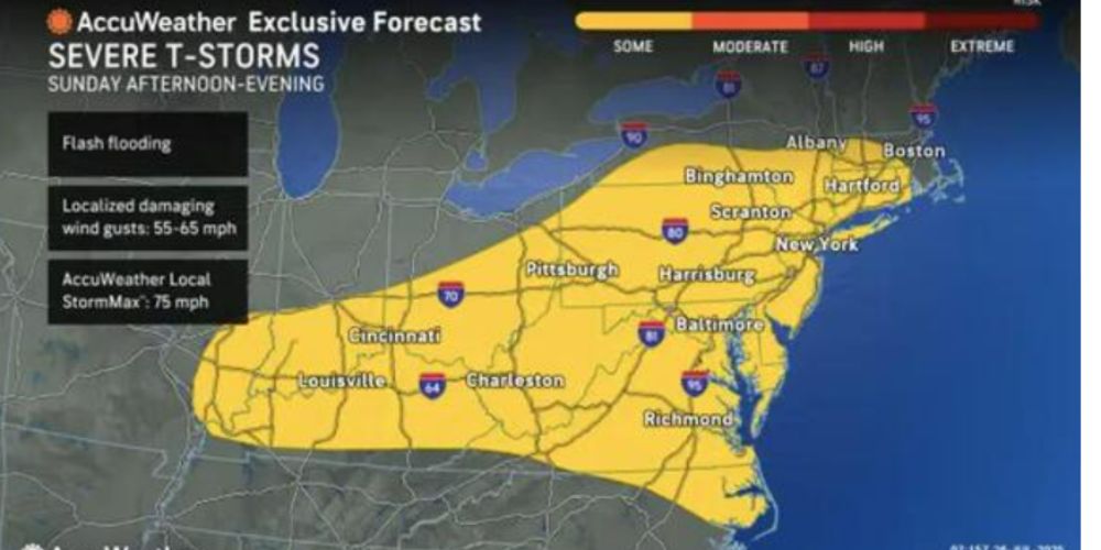
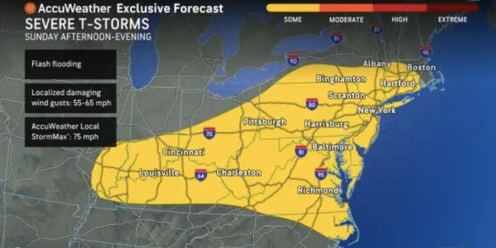
Heavy Rainfall and Flash Flooding Threat
Heavy rainfall will cause flash flooding across the coastal Carolinas through Monday, with the storm expected to deliver 2 to 4 inches of total rainfall and local amounts reaching up to 6 inches throughout the Carolinas.
Chantal will produce minor storm surge along parts of the Carolina coastline, with coastal areas under the Tropical Storm Warning facing possible storm surge between 1 to 3 feet.
The system will also generate life-threatening surf and rip currents along portions of the East Coast from northeastern Florida to the Mid-Atlantic states over the next couple of days.
The National Hurricane Center reports that the third named storm of the Atlantic hurricane season typically forms around Aug. 3 on average.


Leave a Comment