National Weather Service (NWS) meteorologists issued extensive flood watches for the Northeast and Mid-Atlantic on Wednesday as strong thunderstorms with heavy rain moved through the region.
Why It Matters
The flood risk for the East Coast comes as the country deals with the aftermath of fatal flash floods in Central Texas over the weekend. The floods killed at least 109 people, including 27 campers and counselors from Kerr County’s Camp Mystic.
Flooding is the second-most deadly weather hazard in the United States, following excessive heat. Water washes away vehicles, resulting in the majority of fatalities.
What To Know
Severe storms struck the East Coast on Tuesday, resulting in many flash flood and severe weather warnings.
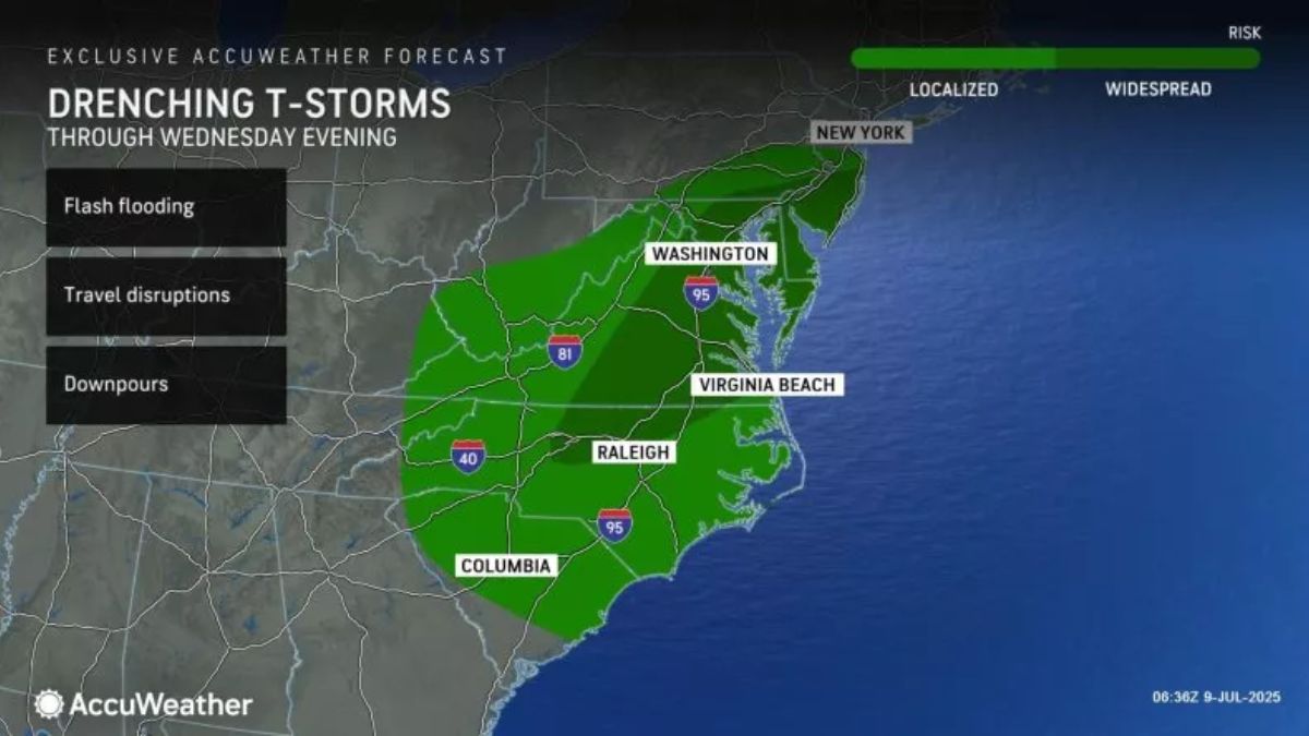
The storms will continue through Wednesday. Flood watches have been issued for six Mid-Atlantic and Northeast states, including Pennsylvania, New Jersey, Delaware, Maryland, Virginia, and North Carolina.
According to an AccuWeather map, the areas most at risk for flash floods are Southern New Jersey, Southeastern Pennsylvania, Delaware, parts of Maryland, Eastern and Central Virginia, and Northern North Carolina.
The image indicated that storm-related downpours could be intense enough to create travel disruptions and flash flooding.
Tropical Storm Chantal’s course earlier this week left some places wet, including Virginia and North Carolina. These locations are “especially vulnerable to flash flooding and stream overflows,” according to AccuWeather.
The severe rain is the result of a blocked cold front, according to an NWS Facebook post on Wednesday. Rain is expected to fall again on Thursday in the waterlogged region.
The NWS’s report provided a map showing the area with the highest risk. South-central Virginia, including Richmond, and far northern North Carolina have the highest risk of extreme rainfall.
“These thunderstorms can get really tall. They are slow-moving, and they can drop a lot of rain, inches of rain per hour,” Sosnowski said. “Even with the high evaporation rates we have in July, you get a pattern like this and you can’t really overcome it.”
What Happens Next
People in flood-watch zones are asked to stay vigilant and follow local weather forecasts, particularly in locations near creeks, rivers, and streams.