

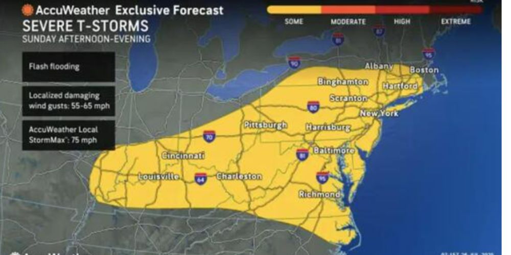
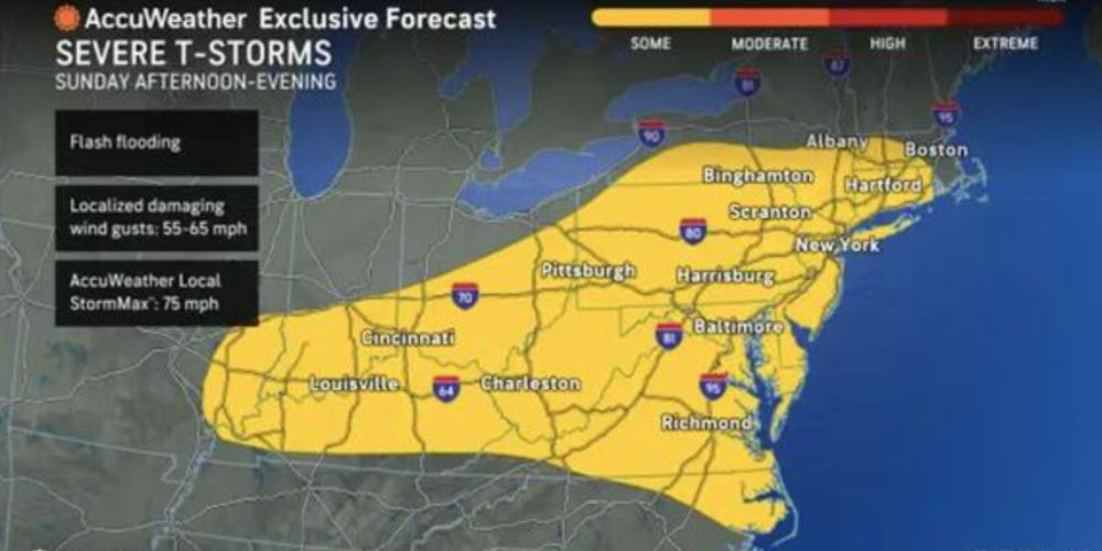
Thunderstorms will hit Pennsylvania, Maryland, Delaware, and New Jersey tomorrow, with some locations receiving more than 2 inches of rain. The greatest downpours are predicted to form along and ahead of a passing cold front, resulting in brief but strong rain that may hamper commutes and outdoor activities.
According to the National Weather Service Middle Atlantic River Forecast Center, the region’s recent dry spell has resulted in streamflows that are near or below seasonal averages, lowering the risk of river flooding even with rain. Showers and thunderstorms are expected to be scattered in the morning before becoming more widespread in the afternoon, with locally heavy cells likely.
Cities such as Philadelphia, Wilmington, Trenton, and Baltimore may experience ponding on highways following heavy rains, particularly in low-lying or poorly drained areas. Drivers are advised to limit their speed on wet roads and avoid locations with standing water. Outdoor events may be delayed or canceled, especially during lightning storms.
Rain will end from west to east by late Wednesday night, with conditions drying into Thursday. There are no river flood warnings in effect, but new advisories may be issued if stronger rains linger.


Leave a Comment