
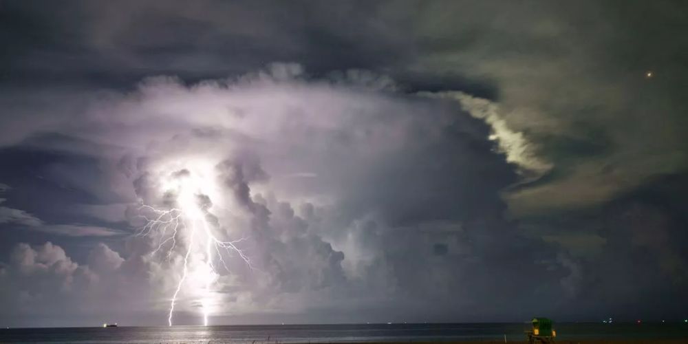
Tropical Storm Dexter is a potential disturbance that could cross over Florida and maybe proceed into Louisiana next week, according to forecast models.
Meteorologist Dylan Federico shared spaghetti models on X, showing the storm shifting west from Florida along the Gulf Coast to Louisiana.
“NEW MODELS bring Invest #93L straight into Louisiana on Friday. Keep in mind if the center reforms south tonight so will the models,” Federico wrote. “A track further offshore would mean it’s more likely this gets named #Dexter. I still think a tropical storm is the ceiling.”
This year’s Atlantic hurricane season has included three named systems: Barry, Chantal, and Andrea.
Chantal delivered significant rain and flooding to North Carolina earlier in July.
This hurricane season runs from June to November.
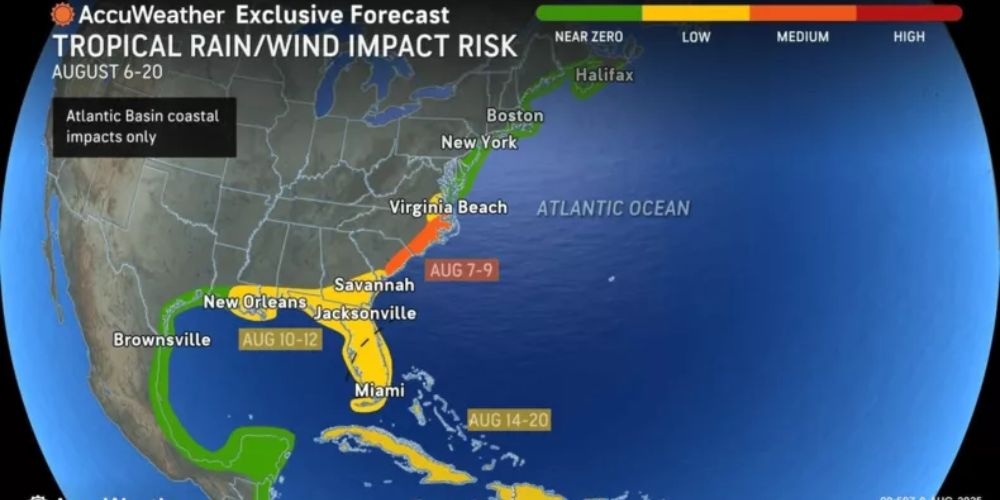
According to AccuWeather projections, the tropical depression will bring heavy rain, a storm surge of 1 to 3 feet, and gusts up to 60 mph to southeastern Louisiana on Thursday afternoon.
If the depression strengthens and turns into a tropical storm before making landfall, it could also impact coastal Mississippi.
Meteorologist Nick Lilja forecasts significant rainfall regardless of location in a Sunday Facebook post.
“If you live anywhere between Galveston and Panama City and within 50 miles of the coast, I’d make certain your property is clear and clean and that water can easily exit your property and get to the drainage areas,” Lilja said.
On Tuesday, he warned that the highest rainfall totals could be recorded in southeast Louisiana and along the Mississippi coast, but that the entire stretch from Morgan City, Louisiana, to Panama City, Florida, should expect “at least a 48-hour period of a washout between Wednesday and Sunday as this thing meanders west.”
While Texas is not in the forecast path, lingering moisture may bring scattered storms to Southeast Texas along the coast, with Houston’s National Weather Service issuing an alert for extreme rainfall east of I-45 on Friday.
The National Hurricane Center reported Wednesday morning that the disturbance, known as Invest 93L, was moving west across the Florida Panhandle.
This is bringing “disorganized” showers and thunderstorms to the region.
” This system is forecast to continue moving westward, and could emerge or redevelop over the far northeastern to north-central portion of the Gulf, reaching the coast of Louisiana by Thursday,” they said.
There is a 40% possibility of a cyclone forming in the next week, as well as a cyclone developing within the next 48 hours.
“If this system moves far enough offshore, environmental conditions over the Gulf appear generally favorable for additional development, and a tropical depression could still form over the next couple of days before the system moves fully inland by the end of the week,” they added.
On X, meteorologist Chris Mulcahy stated that the tropical storm appears “likely more of a possibility over the next two days.”
While things can change, Mulcahy noted that regions of Louisiana are currently in high danger of flooding with rain.
“There’s the potential this feature could become nearly stationary late this week near southeastern Louisiana along the central Gulf Coast. If this happens, there could be a greater concern for heavy, flooding rainfall. Even if this system fails to develop into a tropical depression or tropical storm, we feel there is still a flooding risk due to heavy rainfall,” AccuWeather meteorologist Dan Pydynowski told Newsweek.


Leave a Comment